
An initiative of South Ken Culture Quarter
An initiative of South Ken Culture Quarter
News
16 October 2026
South Ken ZEN+ worked with GiGL to combine environmental data into 13 interactive maps, creating a clearer picture of South Kensington’s biodiversity, green spaces and climate risks. The maps provide a shared evidence base to support future greening projects, climate adaptation and funding applications across the neighbourhood.
In 2025, South Ken ZEN+ commissioned the Greenspace Information for Greater London (GiGL) to help answer that question. The project grew out of our 2024 stakeholder engagement research, which found that organisations across the neighbourhood were already collecting valuable environmental data. The problem was that much of it was held separately, making it difficult to see the full picture. We needed to find a way to bring it all together.
GiGL brought together data from Westminster City Council, the Royal Borough of Kensington and Chelsea, SKCQ members and publicly available sources. This work resulted in a set of 13 interactive maps covering habitats, green infrastructure, tree cover, species records, flood risk and climate change.
The maps allow different layers to be viewed together, making it easier to spot patterns that are harder to see in individual datasets. One map, for example, looks at how different tree species are expected to cope with London’s projected climate in 2090. Another brings green cover and flood risk together, helping us see where nature-based approaches could support climate adaptation.
The mapping has also helped us understand where green space and biodiversity are concentrated, where there are gaps and where we could benefit from collecting more data. Recent surveys from organisations across the South Ken ZEN+ network, combined with historic datasets, have given us a much fuller picture of the neighbourhood. Information that previously sat in different places can now be viewed side by side, giving everyone involved a common reference point.
In November 2025, local authorities, universities, cultural institutions and environmental organisations came together at a Biodiversity Baseline Workshop to review the maps, identify gaps and discuss future priorities. Their feedback helped refine the maps, and participants agreed they provided a useful starting point for planning.
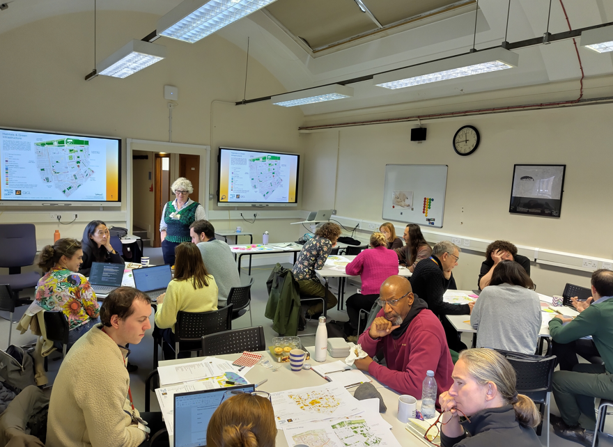
Biodiversity workshop held on 19 November 2025
As a result, we now have a practical resource that can support conversations about future greening and biodiversity projects, help strengthen funding applications and guide decisions about where action could make the greatest difference. The next step is to build on this foundation, improving our understanding of habitat condition and environmental risks while exploring practical ways to bring more nature into the neighbourhood. Ideas discussed include mobile planters and more wildlife-friendly planting and mowing, with small-scale trials helping to inform future projects.
There is still plenty more to learn, and the maps will need to grow as new surveys and records become available. But we now have a shared starting point and a much clearer picture of what we know about nature in South Kensington.
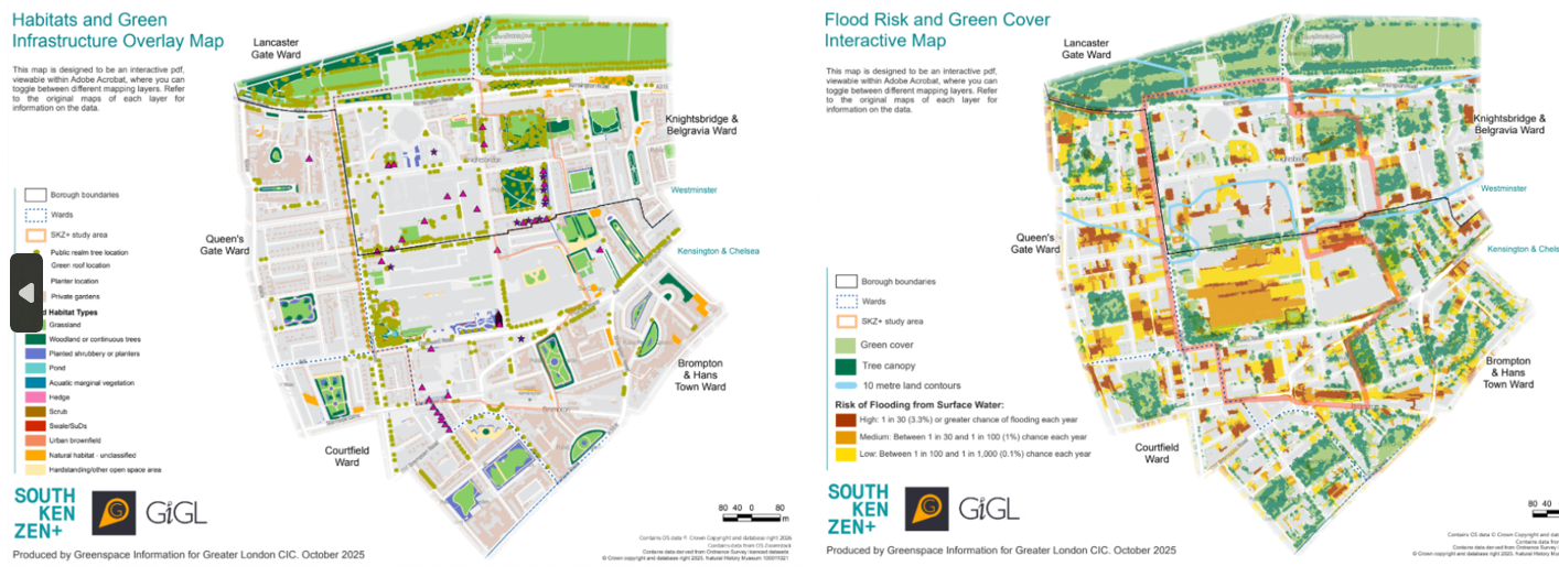
Flood Risk and Green Cover Interactive Map
